Announcements
• Hope to schedule next Working Group
meeting for Feb 15th
• There will be a public workshop at
the Tobin School, 6-8 pm, February 8th.
Jerry’s
Pond
• Eric Grunenbaum
(Contact info: Eric.Grunenbaum@gmail.com) proposes that this
pit wants to be a pond
• It was one of main swimming holes
for city
• Used to look like a natural setting
• What did it used to be? What could
it be?
• Remember...one of the expressed desires
of the Alewife Working Group is to leverage ecology for educational value
• Potential green space-- empty brick
plaza
• Eric proposes signage that tells the
story of this space
◦
Blue
on each post, represents projections for sea level rise
◦
Each
panel will have information: placemaking,
environmental history, and piece of climate information
Considering
the Environment
1 Resilience from sea level rise,
storm surge, and precipitation (goal: reduced vulnerability)
2 Energy (goal is reduced GHG emissions
and enhanced resilience)
3 Water (goal is water conservation,
clean waterways, and reliable drinking supply…”looking at questions stormwater runoff, in terms of quality of water...and other
items on the list” (speaker gave very brief listing of environmental concerns)
4 Also listed on the PowerPoint is
Materials and Waste (goals are soil remediation, zero waste goals, circular
economy)
◦
Says
he will highlight environment tonight
Vision
for a unique neighborhood combines FLOOD MITIGATION with walkability
• Find a systemic solution to impacts
of climate change by aligning with the preparedness planning process.
◦
Build
to an elevation of 4’ or under for the first habitable floor level, which
reduces flood risk from 2070 SLR/SS
◦
It
is a difficult compromise- pedestrian friendly AND protected from flooding with
sea level rise
A
network of green infrastructure
• Propose a green link that envisions
a land-efficient open space network that links the Alewife T to Fresh Pond.
◦
The
path could link to the pedestrian/bike bridge to Alewife T station
◦
Deal
with stormwater issues with bioswales
▪
Midblock
stormwater gardens
◦
FURTHER STUDY
will explore the potential to tie this to a district-wide STORMWATER strategy
◦
Bioswales mostly for storing water. Because of clay content of soils,
not naturally permeable, so system would store water longer (in other words,
water runoff wouldn’t infiltrate into groundwater)
◦
QUESTION
from committee member (man with beard) to be asked later-- how does water LEAVE
the system…
Preparing
for sea level rise
• We think first habitable floor
should be at 4’ -considering projections to 2070. Less than 10% storms above
that line.
◦
Rather
than isolated entry points into building, continuous raised platforms the
public realm. Can walk on sidewalk OR at that level
◦
All
parking must be below 4’ elevation and covered by a building or landscaped deck
◦
Continuous
12’ wide raised platform at 4’ elevation for all the A Streets
There
are four scenarios
• First two do not mention anything
about avoiding building in floodplain
• Third option, Mixed-use commercial,
says ‘minimize residents in the floodplain’
• Fourth option, Mixed-use industrial,
says ‘Avoid building residential in floodplain’
Baseline
• Lacking in district-wide strategy
for flood mitigation
Scenario
1: Optimized Baseline
• Stormwater gets out of the system through the
mid-block open space network. This improved block structure allows for a
systemic stormwater solution.
• Green spaces connect to edge of B
Streets. 30’ side yard setback between parcels on B Streets
• B Street Front Lot Line Setback is
8’’ for a planting zone
• Environmental improvements: more
open space in the middle of the block than what is in existence
• Closest to the baseline in terms of
annual energy consumption, GHG, emissions, and waste
• Greatest generation potential from
solar PVs relative to annual consumption
• This scenario introduces a bike-ped path with a stormwater
function and associated open spaces along it
Scenario
2: Mixed-use Residential
• Green spaces more often within
parcels, not side yards (so less effective at moving out stormwater??).
Mid-block open space network is more narrow than in
optimized baseline scenario.
• Again, green spaces connect to edge
of B Streets. 30’ side yard setback between parcels on B Streets
• Again, B Street Front Lot Line
Setback is 8’’ for a planting zone
• Again, this scenario introduces a
bike-ped path with a stormwater
function and associated open spaces along it
• Again, Improved block structure
allows for a systemic stormwater solution, but LESS
PERVIOUS SURFACE will require MORE AGGRESSIVE STRATEGIES on building roofs
• With this scenario, the higher
density makes district energy possible
• This scenario has the HIGHEST WATER
DEMAND due to higher proportion of residential land uses
Scenario
3: Mixed-use Commercial, Same urbanism, but commercial emphasis
• Again, a narrow mid-block open space
network
• Again, green spaces connect to edge
of B Streets. 30’ side yard setback between parcels on B Streets
• Again, B Street Front Lot Line
Setback is 8’’ for a planting zone
• Again, this scenario introduces a
bike-ped path with a stormwater
function and associated open spaces along it
• “Business case” for district
energy/heating is strongest, given the HIGH DENSITY of commercial and lab
uses...could support a co-gen plant
• Have the HIGHEST energy consumption,
waste generation, and GHG emissions
Scenario
4: Mixed-use Industrial
• Again, mid-block open space network,
but looks VERY narrow
• Again, B Street Front Lot Line
Setback is 8’ for a planting zone
• NOTE: here, green spaces DO NOT
connect to edge of B Streets
• CANNOT do bike-per bath with a stormwater function and associated open spaces along it
• Land use and low density lead to
LEAST energy demands
• Significant solar potential (when
compared to consumption) given the large flat roofs
• Places FEWEST RESIDENTS in the
FLOODPLAIN
• Best PV potential given the
consumption to production ratio
QUESTION
ABOUT THE ENVIRONMENT:
• Referring to the slide with the
matrix on it (Scenarios on horizontal, considerations on vertical)...Why do we
have suitability for flood mitigation in same row as suitability for district
energy? These are two very different things…
◦
RESPONSE:
We have all data...but what do we do with it? We are still in this shower of
data and trying to make sense of it all
◦
COMMENT
FROM QUESTION ASKER: Scenarios that work for district energy,
would mean highest energy consumption. This is confusing. These environmental
factors are being categorized as if they are all the same- should be sorted out
better
COMMENTS
FROM COMMITTEE MEMBERS ABOUT THE ENVIRONMENT:
• Older man: Intrigued by mixed-use
commercial or industrial. Flood plain issues, keeping residents out of there.
So I am tipping towards commercial/industrial.
• Karen: I just want to see the
bike-pedestrian path in there. Make it more transit-oriented, ease the traffic
congestion.
PUBLIC
COMMENTS ABOUT THE ENVIRONMENT:
• Woman: in addition to soils being
water reservoirs, any green space will take pressure off Fresh Pond, and the
amount of dog traffic it gets. Concerned about that pollution.
• Another woman: this is one massive
heat island. I think we need to give climate change its due weight. And I like
the idea of an outside green space, a central green space. The green for stormwater is excellent. But need some larger green space.
• I want to make sure green space is
for public use.
• Mike: likes industrial, if there is
flooding, less residential in harm’s way, would suggest building in a natural
resource center for this flood zone.
OTHER
COMMENTS FROM COMMITTEE MEMBERS (not related to the environment)
• Man with beard likes a line between
mixed-use commercial and mixed-use industrial. Wants building the bridge to be
a goal, make sure we generate revenue through this plan. Likes the raised
pathway. Also, need some community space, some center.
• Margaret: Mixed-use residential also
gets us the bridge. I was really intrigued by mixed-use industrial. Keeping
jobs in Cambridge.
• Doug: scenarios are great, but we
need to get down to what this will actually be. Mixed-use commercial is much to
intensive, very little room between the buildings. Mixed-use industrial
intriguing because it provides home for existing businesses that people already
like and use. Truth is it might not be an entire
industrial zone, but preserving at least a small area of industrial activity.
If you have a 200 foot overlay, that land value will
skyrocket and it will put businesses out of business.
• Eric: I think we should start
calling it industrial/fabrication space...I like the idea of that being an
entree to the existing conditions to continue. A smaller space that might not appeal
to bigger industrial.
• Catherine: I like concept of
mixed-use industrial, but seems least plausible because requires most land
aggregation. I think mixed-use residential looks the most likely to happen
based on parcel distribution. We should have the end-point in mind in more
detail...so we are OK if it happens quickly.
• Jennifer Gilbert: Mixed-use
residential and industrial are what interest me. Commercial entails lots of
trips and travel, and we have heard complaints about congestion. Can we push it
further next time with industrial, and what this means? There is a known and
recognized need for creative space for people who can’t pay Kendall Square
space.
OTHER
PUBLIC COMMENTS (not related to the environment):
• I think I’m in favor of
neighborhoods that have sprinkling of commercial, industrial, residential.
Biggest concerns are resolving traffic issues.
• Ed: Seen industrial done with
everything from experimental spaces for coffee, wind energy…
• Someone who lives nearby-- really
carefully consider traffic. Streets are at a breaking point. Important to take
a look at what these roadways can take.
It would be very helpful if could add population implications-- what would the public facility, traffic implications be?
---Respectfully submitted, FAR
- Home
- Directions
- FAR Wildlife Blog
- Calendar
- News
- Donate Now
- Get Social!
- Storm Water Wetlands
- Plants and Restoration
- Photos
- Videos
- About & Projects
- Master Plan for Alewife
- Archive
- Newsletters
- Contact
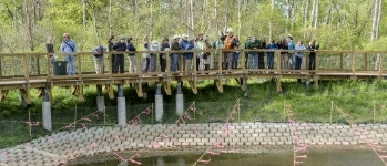
 Presentation Spotlighting Alewife Reservation
 Follow us on Instagram
Forward our web address to a friend!
- An Urban Gem - Alewife Reservation Nature Preserve
- Envisioning The Silver Maple Forest
- History and Policies of Cambridge, Belmont, and DEP
- Storm Water Wetlands
- Friends of Alewife Reservation brochure
(front, back) - Technical Analysis of Upper Alewife Basin
- Watershed: An Excursion in Four Parts
- The River Is A Restless Spirit: Life in the floodplain forest
-
Assessment of Silver Maple forest for DEP Adjudicatory hearings and
Patrick Fairbairn, author of the Assessment - Community Native Garden Flora
The
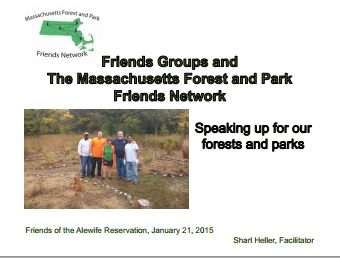
Alewife Reservation
is a unique natural resource for the communities of Belmont, Arlington and Cambridge
and home to hundreds of species, including hawks, coyotes beavers, snapping turtles, wild turkeys and muskrats,
the reservation is a unique natural resource for the community.
Historical information (Powerpoint)
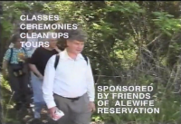
Friends of Alewife Reservation works to protect and restore this wild area and the surrounding area for the water quality, native plants, animals and over 90 bird species with paths for walking, running and biking, recreation, and for classroom education and research. We regularly steward and preserve the Reservation area for wildlife and for the enjoyment of present and future generations.
(video)
By-Laws
About Friends of Alewife Reservation
Statement of Purpose
Citizen Forester newsletter archive
The Birds of the Cambridge Region of Massachusetts

by William Brewster 1906
Nuttal Ornithological Society
Biodiversity Study of Alewife Reservation Area: Species, Habitat, Ecosystems

Inventories by David Brown, wildlife assessor (2003, 2004.) Published by and available from FAR for $10. Write or call for your copy. (sample)
Updated Dave Brown Inventories (2008, 2010)
Inventories of Alewife Reservation Wetland Plants by Walter Kittredge, Botanist (2013)
Email: alewife@greencambridge.org
Join our mailing list
For technical problems with this website, email: webmaster@friendsofalewifereservation.org