From the Director:
This eNewsletter is the start of a regular series of updates from the U.S. Geological Survey New England Water Science Center to all of our collaborators, cooperating agencies, and others interested in the work of our Center. We will inform you of new studies and data initiatives, new reports, and current issues we are addressing—such as the abnormally dry conditions now being experienced in most of New England. If there is a particular topic you would like discussed in future newsletters, let me know at dc_nweng@usgs.gov. I hope you find these newsletters valuable! Best regards, Keith Robinson Director, New England Water Science Center Drought Overview, November 2016 Currently, most of New England is experiencing some level of drought based on streamflow and groundwater data collected by the USGS. Many areas have streamflow in the lower quartile compared to historical conditions for November (maps), and groundwater levels are considerably below normal for this time of year (map). During this summer and early fall, 10 percent of the 540 USGS streamgages in New England set new, period-of-record lows for the 7-day average low flow. In the middle of September, 20 percent of the streamgages set a period-of-record low flow for that day in history. Although there has been relief in flows and groundwater levels in some areas due to recent rain events, the drought has persisted for several months, and has been severe at times over much of CT, RI, MA, southern NH, and ME. In response, USGS has supported state drought committees and local communities by providing critical streamflow, groundwater, and climate data. Go to our drought page for current hydrologic conditions across New England, and state-by-state links. Each of the state-by-state links provides relevant USGS and state-agency contacts. The New England USGS contact is Gardner Bent gbent@usgs.gov NEW STUDIES IN THE NEW ENGLAND WATER SCIENCE CENTER International Lake Champlain flooding study: Vermont, New York, and Quebec Our Center is working with the International Joint Commission to initiate a flood preparedness, mitigation and forecasting system for Lake Champlain and the Richelieu River in Quebec, Canada. The new 2017 study will be based on tasks identified in a 2013 Plan of Study prepared following the record-setting floods of 2011. Contacts: Rob Flynn rflynn@usgs.gov or Keith Robinson kwrobins@usgs.gov. Alternative water-quality criteria for aluminum in Massachusetts wastewater discharge Aluminum limits in Massachusetts wastewater discharge permits can be difficult to achieve because natural, instream aluminum concentrations are relatively high in many parts of the state. USGS, in cooperation with the MA Department of Environental Protection is quantifying reductions in aluminum toxicity associated with co-occurring dissolved humic substances, which have the potential to mitigate the toxicity of aluminum to fish and other biota. Study results could benefit MassDEP and local communities in the establishment of water-quality criteria that are better suited to the range of natural, baseline conditions in Massachusetts waters. Information contacts: John Colman jacolman@usgs.gov or Laura Blake lblake@usgs.gov Climate change, hydrology, and Atlantic salmon, Meduxnekeag River basin, Maine Projections for climate change in the northeastern U.S. include warmer temperatures and increases in precipitation. In cooperation with the Houlton Band of Maliseet Indians, the USGS will develop and calibrate a model of the Meduxnekeag River watershed, and use the model to estimate future hydrologic changes, based on projected climate inputs. Present and estimated future hydrologic conditions to be documented will include streamflow quantity and seasonal timing, snow accumulation and melt, and water temperatures. Model results would provide input to Atlantic salmon survivability models, and result in a useful tool for estimating salmon vulnerability to climate change. Contacts: Rob Dudley rwdudley@usgs.gov or Greg Stewart gstewart@usgs.gov Stream quality in the northeastern United States In the summer of 2016, the USGS collected hundreds of stream quality samples across the northeast, as part of its Northeast Stream Quality Assessment (NESQA) project in the USGS National Water-Quality Program. The goal is to assess the quality of streams in the region by characterizing multiple water-quality factors that act as stressors to aquatic life, and to evaluate the relation between these stressors and biological communities. The 2016 effort focused on the effects of urbanization and agriculture on stream quality in all or parts of the six New England states, New Jersey, New York, and Pennsylvania. Findings will provide the public and policymakers with information about the most critical factors affecting stream quality, and is expected to yield insights about potential approaches for protecting the health of streams in the region. Contacts: Jim Coles jcoles@usgs.gov or Jon Morrison jmorriso@usgs.gov. New data initiative: Tide gages for New England coastal communities On Tuesday, November 15, the USGS and the Northeastern Regional Association of Coastal Ocean Observing Systems (NERACOOS) co-hosted a press event to celebrate the installation of a new, real-time tide gage on the Saco River at Camp Ellis near Saco, Maine. This event highlighted how the data will be utilized to assist local coastal zone managers, emergency officials, researchers, and the general public. The event also stressed the cooperation between the local, State, and Federal agencies, and NERACOOS required to get this gage installed and operational. The Saco River gage is the latest addition to a network of 18 tide gages that USGS is now operating in New England. USGS is cooperating with a variety of partners, including communities, state agencies, and others to support and operate the gages.Contacts: Nick Stasulis (ME) nstasuli@usgs.gov, Richard Kiah, (NH) rkiah@usgs.gov, Richard Verdi (MA, RI) rverdi@usgs.gov, and Jon Morrison (CT) jmorriso@usgs.gov New Reports since June 2016 1. Phosphorus concentrations and loads in the Assabet River, Massachusetts, before and after wastewater treatment facility upgrades. Savoie, J.G., DeSimone, L.A., Mullaney, J.R., Zimmerman, M.J., and Waldron, M.C., 2016, Changes in phosphorus concentrations and loads in the Assabet River, Massachusetts, October 2008 through April 2014: U.S. Geological Survey Scientific Investigations Report 2016–5063, 40 p. http://dx.doi.org/10.3133/s ir20165063. 2. A daily water-balance model for evaluating effects of reservoirs and other impoundments on downstream flows Massachusetts. Levin, S.B., 2016, Effects of water-supply reservoirs on streamflow in Massachusetts: U.S. Geological Survey Scientific Investigations Report 2016–5123, 35 p. http://dx.doi.org/10.3133/s ir20165123. 3. Bedrock aquifer characteristics in a portion of Haddam, Connecticut Johnson, C.D., Kiel, K.F., Joesten, P.K., and Pappas, K.L., 2016, Characterization of fractures and flow zones in a contaminated crystalline-rock aquifer in the Tylerville section of Haddam, Connecticut: U.S. Geological Survey Data Series 1020, 40 p., http://dx.doi.org/10.3133/ ds1020. 4. Summary of studies by the USGS in the Namskaket Marsh area, Orleans, Massachusetts. Weiskel, P.K., Barbaro, J.R., and DeSimone, L.A., 2016, Environmental conditions in the Namskaket Marsh area, Orleans, Massachusetts—A summary of studies by the U.S. Geological Survey, 1989–2011: U.S. Geological Survey Scientific Investigations Report 2016–5122, 29 p., http://dx.doi.org/10.3133/ sir20165122. 5. Flood-inundation maps for a portion of the Green River basin near Greenfield, Massachusetts. Flynn, R.H., Bent, G.C., and Lombard, P.J., 2016, Flood-inundation maps for the Green River in Colrain, Leyden, and Greenfield, Massachusetts, from U.S. Geological Survey streamgage 01170100 Green River near Colrain to the confluence with the Deerfield River: U.S. Geological Survey Scientific Investigations Report 2016–5107, 18 p., https://doi.org/10.3133/si r20165107.- Home
- Directions
- FAR Wildlife Blog
- Calendar
- News
- Donate Now
- Get Social!
- Storm Water Wetlands
- Plants and Restoration
- Photos
- Videos
- About & Projects
- Master Plan for Alewife
- Archive
- Newsletters
- Contact
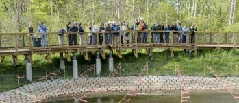
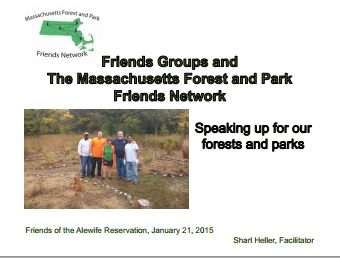 Presentation Spotlighting Alewife Reservation
 Follow us on Instagram
Forward our web address to a friend!
- An Urban Gem - Alewife Reservation Nature Preserve
- Envisioning The Silver Maple Forest
- History and Policies of Cambridge, Belmont, and DEP
- Storm Water Wetlands
- Friends of Alewife Reservation brochure
(front, back) - Technical Analysis of Upper Alewife Basin
- Watershed: An Excursion in Four Parts
- The River Is A Restless Spirit: Life in the floodplain forest
-
Assessment of Silver Maple forest for DEP Adjudicatory hearings and
Patrick Fairbairn, author of the Assessment - Community Native Garden Flora
The
Alewife Reservation
is a unique natural resource for the communities of Belmont, Arlington and Cambridge
and home to hundreds of species, including hawks, coyotes beavers, snapping turtles, wild turkeys and muskrats,
the reservation is a unique natural resource for the community.
Historical information (Powerpoint)
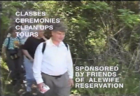
Friends of Alewife Reservation works to protect and restore this wild area and the surrounding area for the water quality, native plants, animals and over 90 bird species with paths for walking, running and biking, recreation, and for classroom education and research. We regularly steward and preserve the Reservation area for wildlife and for the enjoyment of present and future generations.
(video)
By-Laws
About Friends of Alewife Reservation
Statement of Purpose
Citizen Forester newsletter archive
The Birds of the Cambridge Region of Massachusetts

by William Brewster 1906
Nuttal Ornithological Society
Biodiversity Study of Alewife Reservation Area: Species, Habitat, Ecosystems

Inventories by David Brown, wildlife assessor (2003, 2004.) Published by and available from FAR for $10. Write or call for your copy. (sample)
Updated Dave Brown Inventories (2008, 2010)
Inventories of Alewife Reservation Wetland Plants by Walter Kittredge, Botanist (2013)
Email: alewife@greencambridge.org
Join our mailing list
For technical problems with this website, email: webmaster@friendsofalewifereservation.org