Comments by Ellen Mass, Friends of Alewife Reservation
Appellant for DEP case # 123-0180
Submitted to Heidi Davis,
Acting Section Chief at Mass Department of Environmental Protection Wetlands Program.
Cambridge Open Space Maps through 2016- FEMA
See City of Cambridge entire Open Space Report with Maps projected through 2016 which reveals FEMA areas for protection and wet substratum of site visit parcel proposal:
https://www.cambridgema.gov/CDD/parks/osplanning/openspaceplan.aspx
See special Alewife district maps:
http://friendsofalewifereservation.org/2013-10-02_osplan_2010_map42-2.pdf
See maps 4-1- 4-4 for watershed, water, soils in Cambridge.
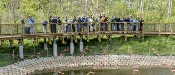
Note recent site visit walk and high ground water with clay substratum.
See flooding photos of Cambridge Park Drive from 2008 sent to Heidi Davis 1-20-14.
FEMA Flood Elevation Changes and Modeling Datum
See attached basic FEMA floodplain map.
Even with the high water table at this floodplain and DCR park of Alewife Reservation site, and the Arlington floodway and wetlands on the EAST side of Acorn Park Drive exit to the 'T' ramp, the City has looked at the proponent's flood storage elements and approved based on a 7.6 NGVD29 and special permit allowed #46. But the proponent's plan for flood retention storage is not clear because of regulations limiting ground water penetration and displacement which can occur at a far distance, affecting towns further north and east. Geologic investigation concerns may be another cause for delay until the hydrologic and geophysical factors are clearer with the City's Vulnerability Assessment and Mass Highway Artery study together with Woods Hole and City of Boston published in June 2014. We will not be able to ascertain what future protections are required for this region of the Boston metropolis and our western corridor until the in-depth regional studies are done which will indicate massive flooding for this region during high hurricane level storms. The June 2014 Vulnerability Assessment, a state-wide initiative will either confirm or contradict the proponent's flood assessment predictions. Also, that the NAVD 88, base line water elevation datum rather than the NGVD 29, might be substituted for an outdated datum. See LINK which explains the 88 method of FEMA (although there was a clarification today that the 7.6 1929 elevation was only used for consistency with the former permitting process).
Reasons for using NAVD calculations and not NVGD29.
http://training.fema.gov/EMIWeb/CRS/440%20BMM%20NGVD-NAVD.pdf
FEMA Regulations Discussed with Alewife Conservationist
Following is a quote from FEMA officer 2012 conversation with resident which lays out the process for complying with its regulations and explains its enforcement limitations:
"FEMA does not like to see development in a floodway, which is why there are strict requirements in the NFIP regulations that make it very difficult for a developer to construct in a floodway, though not impossible. Please see CFR 65.12, as previously discussed."
http://friendsofalewifereservation.org/2013-10-02_Route_2_developments_and_flooding_at_Alewife_and%20surrounding_towns.htm
FEMA and Wetlands Protection Act- WPA
According to Fred Paulsen, former head of the Belmont Uplands Advisory Committee, and former Chair of the Mystic River Watershed Association in his official report to Belmont, he also noted the FEMA changes in 2008 related to the Belmont Uplands adjacent to #600.
From Fred Paulsen to the town of Belmont: Relates to nearby development in the 100 year floodplain.
"As reported by BSC (a consultant to Bulfinch, who is the developer of Cambridge Discovery Park), ENSR, consultant to FEMA, shows (on a preliminary basis) an increase of 29 inches in the 100-year flood elevation over the 1982 FEMA study (from 8.2 to 10.6 feet elevation). A higher 100-year flood level subjects a greater portion of the buildable area of the Uplands to (a) the state Building Code requirement to place the lowest floor of any building above the 100-year base flood elevation and (b) the Wetlands Protection Act (WPA) requirements (i) for compensatory flood storage to be located adjacent to the impacted areas, and at the same elevation from which flood storage is being removed, and (ii) for inventorying and taking into account larger significant wildlife habitat areas."
Floodway and BLSF
As noted by the Cambridge Conservation Commission, the "floodway" does not need consideration by the CCC because, they say, it is not under "Wetlands Protection Act"; but regulatory professionals say the Wetlands Protection Act (WPA), does include floodway considerations because it is attached to the Bordering Land Subject to Flooding (BLSF). The NOI (Notice of Intent) and CCC’s Order of Conditions from the Commission has checked off that the proposed building area is "significant to groundwater, storm damage prevention, fisheries, pollut. prevention, protection of wildlife habitat and flood control". and is in BLSF, so my claim is that FEMA "floodway" does apply in this case to WPA and that Arlington wetlands 50 plus feet away are also within this WPA jurisdiction.
Alewife Upper Basin
Horsley and Witten Inc. Technical Analysis Alewife Upper Basin- hydrological Report: 2012- Scott Horsley. Area precipitation data and Alewife Basin Study to compare with proponent's data in regards to flood elevation predictability. Please note that
There is a building permit that is pending, and there is another building permit review process which will take place in the future for more and larger buildings. keep in mind on the Route 2 side of Discovery Park, nearly 1 million square feet approved by Cambridge for the Bulfinch "Master Plan" which can overtake the floodplain capacity according to the Horsley Report, devoid of a clear cumulative flood elevation assessment from all new buildings on the floodway and from a regional perspective as Horsley has provided. This part of the Alewife Upper Basin was assessed by noted hydrology firm, Horsley and Witten Co.in 2012 (See study in link) which outlines past and potential impervious surface impacts, and calls into question further reducing pervious surfaces on the site. This report was submitted to legislators in 2012at a special state house event, and is used as a baseline flood indicator for environmental communities of Arlington, Belmont and Cambridge as well as FEMA data.
http://friendsofalewifereservation.org/2012-02-29-Horsley-and-Witten-Technical-Analysis-of-Upper-Alewife-Brook-Basin.pdf
Without taking the regional calculations for flooding and FEMA 2008 elevations as Paulsen and Horsley have stated from their in depth research (Horsley), the project may fly in the face of regional watershed science, having been produced by proponents without stringent calculations of the broad regional Alewife Upper Basin floodplain in mind, and thus possibly eliminating protection for thousands of residents down stream from Little River who live on the watershed and who already pay high premiums for flood insurance.
http://friendsofalewifereservation.org/2013-10-02_Route_2_developments_and_flooding_at_Alewife_and%20surrounding_towns.htm
National Storm Water Compliance
The city might require a new NPDES compliance study of this Acorn Park Drive parcel, which is now unregulated. They have decided in advance not to require the BSC- BHX applicants on the North side to meet the more stringent storm water requirements the city recently adopted for
Town of Arlington and CHLOMR.
Within a short distance of the proposed hotel are Arlington wetlands that function as water retention for the entire Alewife region as storm water comes in from Arlington culverts, and ground water saturates from the floodway that comes from the west, location of the new buildings. It is not clear that Arlington has seen the proponents in a public meeting on this matter and that Arlington citizens who could have severe property damage were notified , or a complete CHLOMR (map change) was widely circulated to the residents who would need to approve the map change. In the NOI report of October 31, 2013, we also see no evidence of full compliance with FEMA’s requirement that because this project exceeds the FEMA water rise limits on a floodway, it must complete a full CHLOMR and we do not see that a LOMR was granted in Fema case # 11-01 2089R.
See FEMA link above.
Storm Water Standards
Another possible regulatory discrepency is that the proponent's parcel on the North Side of Little River IS NOT subject to the Storm water standards of the South side and the revised regulations of the city from 2006 now in operation. See Link. This was explained to me and it is quite alarming that these standards are used in what appears is a discretionary manner.
I would ask that the new national storm water standards (NPDES) be required for the proposed developments at 400-600 Acorn Park Drive as well. They have been officially adopted for the City of Cambridge. Why not this area where storm water run off is a major issue for flooding of many communities down stream?
See regs.
http://friendsofalewifereservation.org/2006_05_stormwatermanagement_opr05U23.pdf
#search=%22storm%20water%20regulations%202006%22
Ellen Mass
President
Friends of Alewife Reservation
186 Alewife Brook Parkway #304
Cambridge, MA. 02138
617 290-4864
617 415-1884 office
- Home
- Directions
- FAR Wildlife Blog
- Calendar
- News
- Donate Now
- Get Social!
- Storm Water Wetlands
- Plants and Restoration
- Photos
- Videos
- About & Projects
- Master Plan for Alewife
- Archive
- Newsletters
- Contact
 Presentation Spotlighting Alewife Reservation
 Follow us on Instagram
Forward our web address to a friend!
- An Urban Gem - Alewife Reservation Nature Preserve
- Envisioning The Silver Maple Forest
- History and Policies of Cambridge, Belmont, and DEP
- Storm Water Wetlands
- Friends of Alewife Reservation brochure
(front, back) - Technical Analysis of Upper Alewife Basin
- Watershed: An Excursion in Four Parts
- The River Is A Restless Spirit: Life in the floodplain forest
-
Assessment of Silver Maple forest for DEP Adjudicatory hearings and
Patrick Fairbairn, author of the Assessment - Community Native Garden Flora
The
Alewife Reservation
is a unique natural resource for the communities of Belmont, Arlington and Cambridge
and home to hundreds of species, including hawks, coyotes beavers, snapping turtles, wild turkeys and muskrats,
the reservation is a unique natural resource for the community.
Historical information (Powerpoint)
Friends of Alewife Reservation works to protect and restore this wild area and the surrounding area for the water quality, native plants, animals and over 90 bird species with paths for walking, running and biking, recreation, and for classroom education and research. We regularly steward and preserve the Reservation area for wildlife and for the enjoyment of present and future generations.
(video)
By-Laws
About Friends of Alewife Reservation
Statement of Purpose
Citizen Forester newsletter archive
The Birds of the Cambridge Region of Massachusetts

by William Brewster 1906
Nuttal Ornithological Society
Biodiversity Study of Alewife Reservation Area: Species, Habitat, Ecosystems

Inventories by David Brown, wildlife assessor (2003, 2004.) Published by and available from FAR for $10. Write or call for your copy. (sample)
Updated Dave Brown Inventories (2008, 2010)
Inventories of Alewife Reservation Wetland Plants by Walter Kittredge, Botanist (2013)