| Friends of Alewife Reservation (FAR)
|
|
|
|
|
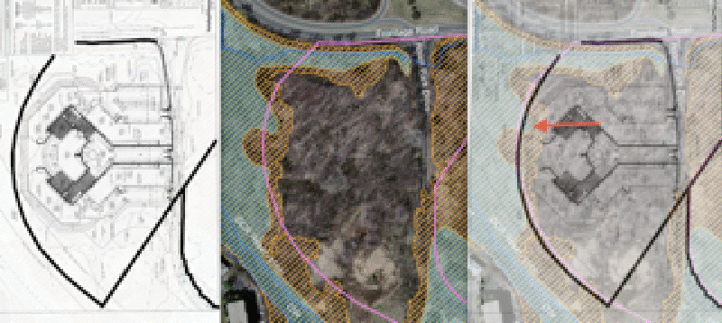
FEMA floodway encroaches on fire-road at the least
Idith Haber (November 10, 2011) Attached is a file composed of 3 images:
I used the contours of the property lines and municipal borders to line up.
My understanding of FEMA regulations is that any encroachment into the floodway by a development which would require "filling" means they have to have a no-rise certification by a professional engineering, or they have to change their plans. The developer's plans show an 1/8 inch rise during a 24-hour storm of the floodway. I will have to look into these regulations again.
|