link to home page - photo in alewife reservation Friends of Alewife Reservation (FAR)

FAR home page

Search

Events     News     Image Collections
Archive & Links (text, maps, photos)

What we do (Volunteer!)
About FAR
Contact FAR
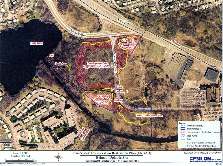
Conceptual conservation restriction plan map - Oct 14, 2003
New residential planning - Belmont Uplands


Map (in color, based on MassGIS photo) shows:
  • Town boundary
  • Site boundary
  • Conservation restriction parcels
  • Trail area
  • Trail
  • Current wetland delineation
  • Former wetland delineation
  • Development area
map
large image (downloading takes about 35 seconds with a 56.6 Kbps dial-up modem)