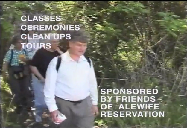
Protecting the Alewife Floodplain
The recent state court decision favoring the Town of Arlington and a federal mapping study of the floodplain around the Alewife Brook watershed both offer long-awaited recognition of the severity of flooding in this fragile area, and add support to long-standing and broad-based efforts to protect open space in the region.
Court Ruling on Mugar Case
The Commonwealth of Massachusetts Appeals Court, on September 24, 2004, affirmed a Superior Court ruling of September 2002 in favor of the Arlington Conservation Commission (ConCom), in the case of Finard & Company LLC (as agent for the Mugar interests) versus the Town. The earlier ruling held that ConCom was within its authority and acted reasonably when it rejected the Mugar group’s proposed delineation of the 100-year floodplain boundaries at the 17-acre site in East Arlington adjacent to Route 2 and the Alewife Reservation.
According to ConCom chair Nathaniel Stevens, this decision means that ConCom can demand additional studies before agreeing with the developer as to which portions of the site are subject to the 100-year flood criterion, which then determines mitigation requirements. The floodplain is measured as the height above sea level which a 100-year flood is expected to reach. That elevation translates into a line on a map; all the land at or below that elevation, and next to a water body, is considered in the floodplain.
The Mugar team had proposed an elevation of 8.2 feet above sea level, based in part on the FEMA (Federal Emergency Management Agency) map last updated in 1982. After looking at the current realities of the area, the filling and development of recent decades, and the documented changes in rainfall patterns, ConCom determined that (1) the flood elevation was likely to be higher than 8.2 feet, and (2) there was not enough information available to say what that elevation should be and more detailed study must be done before the elevation question could be answered.
Both the Superior and Appeals courts found that the ConCom decision was reasonable and supported by substantial evidence. This action was taken under the Town of Arlington’s local Wetlands Protection Bylaw, and ConCom prevailed because the local bylaw is more stringent than the state wetlands Protection Act. Under the state act alone, the developer would have had the right to use the obsolete 1982 FEMA elevation.
FEMA Floodplain Study
Quite coincidentally, FEMA last month released preliminary results of its floodplain study, which is being conducted in large part because of pressure by many local citizens political leaders (notably Rep. Anne Paulsen of East Arlington and Belmont) to obtain a complete updating of the floodplain map for the Mystic River basin, including the Alewife area. The consultants’ findings show a 100-year flood elevation at nearby Little River of between 10.6 and 10.8 feet — more than two feet above the current FEMA level of 8.2 feet.
FEMA’s final report will not be available until some time in 2005, but this news validates the experience of residents in low-lying areas of East Arlington, Belmont and Cambridge, who have long been living with a different reality than that shown on the current FEMA map and claimed by developers. They ask, “How can we get a ‘100-year flood’ every couple of years?” The answer of course is that we have not had a 100-year flood. A 100-year flood would be much, much worse.
The combination of the state court ruling and the new FEMA mapping results will force any future development in the Alewife area to take the revised floodplain and elevation data into account (or, if reason prevails, prevent certain parcels from being developed at all). It also raises a concern for East Arlington, Belmont and Cambridge residents whose property will now be recognized as being in the floodplain, and who may therefore be required to obtain flood insurance in the future. State and local officials are conferring on possible assistance programs to help homeowners with this transition.
Related Case in Chatham
In another potentially relevant case, a state Appeals Court decision in mid-September upheld the Town of Chatham's right to prohibit new construction in a 100-year flood zone (Cape Cod Times, September 22, 2004). Chatham had ammended its zoning bylaw in 1985 to establish areas within the 100-year floodplain as an overlay conservancy district, under which allowed uses include agriculture and outdoor recreational activities. A landowner who had owned a parcel for many years (prior to enactment of the bylaw change) desired to sell the parcel for development, and claimed that the Town restriction was a “taking” for which the Town must compensate her.
The court found that the owner did not lose all economic value of her land, since she is still able to sell it for recreation or conservation use, and therefore the case did not constitute a taking. The court also found that the restriction substantially advanced a legitimate state interest. This decision has important implications for many other towns in the state with coastal and wetland areas where construction could affect the environment, public safety and residents’ insurance rates.
Land Trust To Hold Conservation Restriction On Symmes Open Space
by Brian Rebrig
Throughout the three-year planning process for the redevelopment of the Symmes site, there has been heated debate over many aspects of the project, from affordable housing to medical uses to the overall density of development. One facet of the project that has been almost universally supported is the conservation of approximately half of the site as open space, for the benefit of the public.
We are pleased to report that the Land Trust will help to protect this resource by serving as a legal holder and monitor of the Conservation Restriction (CR) to be placed on the property, together with the Arlington Conservation Commission.
A CR is the highest form of permanent protection available under Massachusetts law. The right to monitor and enforce a CR is given to a land trust, a municipal body, the state, or some combination; in this case, the plan is to name both the Arlington Land Trust and the Town of Arlington Conservation Commission as co-holders, so that both a nonprofit organization and a governmental agency have standing to monitor the CR. The land will be owned by the developer, so that the developer (and later the successor condo association) will be responsible for the cost of maintenance. The CR, together with the Special Permit to be issued by the Arlington Redevelopment Board (ARB), will govern the standards to which that maintenance is conducted and will protect the public’s right of access.
The Summer Street Woods at the foot of the hill will be preserved as naturalistic open space. It is hoped that with improved stewardship over the existing woodlot dominated by Norway Maples can be cleaned up and diversified to include native tree species and understory plantings. The existing oaks in the bigger areas around the perimeter of the site will be retained and other native shade trees will be introduced in areas that require restoration. The steep slopes and ledges will be cleared of debris and otherwise maintain naturally. Rustic trains throughout the woods to the top of the site will be made of wood chips that some from the tree work on site, with steps of wood or stone through the steep sections.
The Symmes Vista Park, a one-acre public space at the most prominent viewing area of the site, will preserve a gathering space with a spectacular overlook of the Boston basin. Public access to this and all the open space areas on the site will be guaranteed by the CR.
The details of landscape design for the entire site, together with the architectural specifications of the buildings, will be shared through the Environmental Design Review (EDR) process conducted by the ARB over the next several months. Through this public process the ARB will test the developer's preliminary plans regarding mitigation of development effects on traffic, runoff and construction disruption, along with aesthetic design considerations. As of this writing the developer had not yet filed for a special permit, which will trigger the EDR process. Residents are encouraged to watch for and attend those ARB sessions and to help shape the final outcome.
The Land Trust will be seeking members to assist with the responsibility of monitoring the CR, and would especially welcome help from those who are residents of the neighborhoods surrounding the Symmes site. If you are interested in this process, please contact ALT for more information.
(from Arlington Land Trust News, Vol.1 No.1, Fall 2004)